
China Rejects India Map Update of 27 Arunachal Pradesh Locations Calling Standardization Invalid
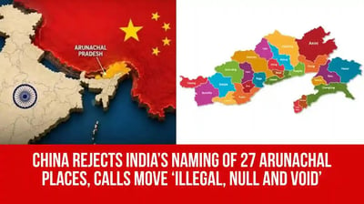
Tensions between New Delhi and Beijing escalated following official statements from the Chinese Foreign Ministry rejecting India's recent cartographic initiative in Arunachal Pradesh. Chinese officials declared the identification and standardization of twenty-seven geographical locations and landmarks on official Indian maps as invalid, maintaining traditional territorial claims over the northeastern frontier region. The diplomatic pushback highlights persistent friction over territorial sovereignty along the eastern sector of the shared border, despite recent efforts from both nations to manage line of control stability.
The controversy originated after the Indian government formally updated official Survey of India maps to incorporate standard names for twenty-seven key geographical features across Arunachal Pradesh, including mountain passes, lakes, and administrative landmarks. Indian authorities initiated the mapping project to ensure uniform cartographic records and counter repeated attempts by Beijing to unilaterally assign Mandarin and Tibetan names to features inside Indian territory. Ministry officials emphasized that assigning standard names reflects routine administrative management within sovereign borders.
Responding to queries during a press conference in Beijing, Chinese Foreign Ministry spokesperson Guo Jiakun stated that China does not recognize the administrative status of Arunachal Pradesh, referring to the area as part of southern Tibet. Chinese officials maintained that unilateral naming efforts on official maps would not alter historical territorial claims or international legal interpretations. Beijing has released multiple standardized name lists for locations across the region over recent years, asserting similar claims that New Delhi consistently dismisses as meritless.
The Ministry of External Affairs in New Delhi swiftly rejected Beijing's diplomatic objections, reiterating that Arunachal Pradesh remains an integral and inalienable part of Indian territory. Official spokespersons affirmed that routine administrative actions, mapping updates, and infrastructure developments within Indian borders fall strictly under national sovereign jurisdiction. Government representatives noted that inventing fictitious names or contesting established geography does not alter the ground reality of Indian administrative control across the state.
Strategic analysts observe that cartographic disputes continue to reflect underlying diplomatic challenges despite ongoing military and diplomatic talks designed to de-escalate border friction. While both capitals have expressed intentions to keep communications open and manage border security through bilateral protocols, recurring disputes over official maps indicate that territorial narratives remain sensitive. Indian defense forces and border agencies continue maintaining standard operational readiness along the Line of Actual Control to secure regional integrity.